


Great Lakes / St. Lawrence Seaway (Highway H2O) Facts
- Opened to deep draft navigation in 1959.
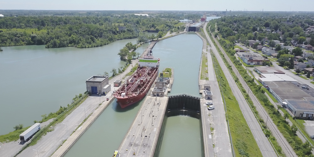
- Lock systems:
Montreal to Lake Ontario – 2 U.S., 5 Canadian
Welland Canal – 8 Canadian
St. Mary’s River – 4 U.S. parallel locks — one transit (Army Corps of Engineers) - Vessel maximum: 225.5 m (740 ft.) length; 23.77 m (78 ft.) beam; 8.08 m (26 ft., 6 in.) draft; 35.5 m (116.5 ft.) height above water.
- Channels maintained at 8.2 m (27 ft.) minimum depth.
- Distance from the Atlantic Ocean to Duluth, Minnesota on Lake Superior = 2,038 nautical miles (2,342 statute miles or 3,700 kilometres), 8.5 sailing days. Includes some 245,750 square kilometres (95,000 square miles) of navigable waters.
- Sailing time (normal conditions) between certain ports on the Great Lakes and the intersection of the Seaway ship channel and Montreal Harbor, using an average speed of 12 mph (10.4 knots)
| Port | Distance (mi.) | Sailing Time (hrs.) | Lockage Time (hrs.) * | Total Hours |
| Thunder Bay | 1,222 | 102 | 17 | 119 |
| Duluth | 1,344 | 112 | 17 | 129 |
| Milwaukee | 1,186 | 79 | 17 | 116 |
| Chicago | 1,251 | 105 | 17 | 122 |
| Port Huron | 680 | 57 | 17 | 74 |
| Detroit | 618 | 52 | 17 | 69 |
| Toledo | 611 | 51 | 17 | 68 |
| Cleveland | 534 | 45 | 17 | 62 |
| Erie | 439 | 37 | 17 | 54 |
| Port Colborne | 374 | 31 | 17 | 48 |
| Toronto | 349 | 29 | 5 | 34 |
| Ogdensburg | 126 | 11 | 5 | 16 |
* Welland Canal: 12 hours; Montreal / Lake Ontario: 5 hours
- Since 1959, more than 2.5 billion tonnes of cargo estimated at $375 billion have moved to and from Canada, the United States, and nearly fifty other nations.
- Almost 25% of Seaway traffic travels to and from overseas ports, especially in Europe, the Middle East and Africa.
- Availability of a specialized laker fleet for maximum efficiency; many equipped with self-unloading devices for unloading at shore facilities (ship to land) or transshipping bulk cargo (ship to ship).
- Includes some of North America’s largest ports, part of an excellent intermodal transportation network.
- Has maintained a near-perfect record of trouble-free navigation through ongoing improvements and meticulous maintenance for more than 50 years.
- Strategic geographical location: directly serves Ontario and Quebec to the north, and Illinois, Michigan, Ohio, Indiana, Wisconsin, Minnesota, New York and Pennsylvania to the south